

Rainwater Basin Wetland Habitat
Funk, Nebraska; Phelps County
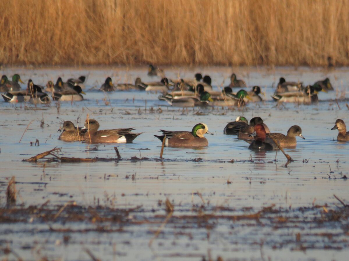
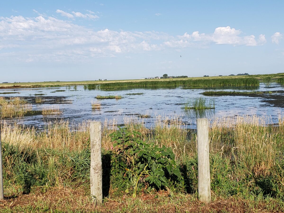
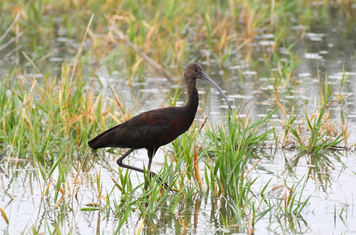
The Rainwater Basin is a landscape of shallow playa wetlands scattered amid the flat-to-gently-rolling loess plains of south-central Nebraska. Before European-American settlement, the region contained some 11,000 wetlands ranging in size from less than an acre to over 1,000 acres. The wetlands were fed by runoff from snowmelt, springtime rains, and intense summer storms, and all but the largest usually dried up by late summer. The growth and succession of wetland plant communities were kept in check by herds of grazing bison, elk, and pronghorns, and by periodic fires. The 160-mile-wide Rainwater Basin region lies at the narrowest point on the Central Flyway migration route. Some 8.6 million geese and ducks stop over here from late February through March on the way to their breeding grounds; shorebirds follow from mid-April through mid-May.
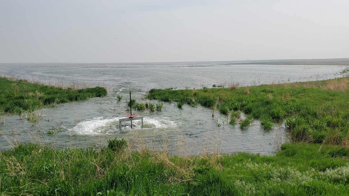
Water management projects can be controversial and divisive, but occasionally everyone can agree to a simple and beneficial solution. The Platte Basin Coalition (PBC) Western Basin Recharge Project benefits multiple agencies and constituencies. Tri-Basin NRD has partnered with U.S. Fish and Wildlife Service (USFWS), Rainwater Basin Joint Venture (RWBJV), Central Nebraska Public Power and Irrigation District (CNPPID), Ducks Unlimited, and Nebraska Department of Natural Resources to deliver surface water to Waterfowl Production Areas (WPAs) within the Tri-Basin NRD. Excess surface water from the Platte River is diverted to the wetlands to supplement natural groundwater recharge, enhance endangered species and waterfowl habitat, while supporting Platte River endangered species instream target flows.
At the Rainwater Basin Wetland Management District, enjoy activities such as wildlife observation and photography, hunting, and hiking and experience the grassland habitats and its wildlife. Check out the three-mile Funk Peterson Wildlife Trail, which loops through the Rainwater Basin Wetland.

Log in to view these resources.
Coming up next:

Fort Kearny
As the number of travelers on the Oregon Trail grew so did the number of military posts along the trail. These posts were established across the West to protect travelers. The first post was founded in the spring of 1848 “near the head of the Grand Island” along the Platte River. It was first called Fort Childs, but was soon renamed Fort Kearny.
Fort Kearny served... Read more

The 100th Meridian
The 100th Meridian is a line is often called where the midwest begins. It is a longitude that is 100 degrees west of Greenwich, England.
The 100th Meridian was also a milestone for the transcontinental railroad. When the Union Pacific construction reached this point there was a celebration. A passenger train brought 250 notable people to this spot in1866 to celebrate. Guests included railroad officials, congressmen,... Read more

Nebraska College of Technical Agriculture (NCTA)
The Nebraska College of Technical Agriculture is devoted to a statewide mission of preparing students for successful careers in agriculture, veterinary technology and related industries. The college provides open access to innovative technical education resulting in associate degrees, certificates and other credentials.
Team Manager Login ![]()
These buttons follow the default direction of each route. You can use the previous button to move in the opposite direction, or edit your team’s settings in the manager dashboard.