

Niobrara National Scenic River
Visitors Center
Valentine, NE; Cherry County
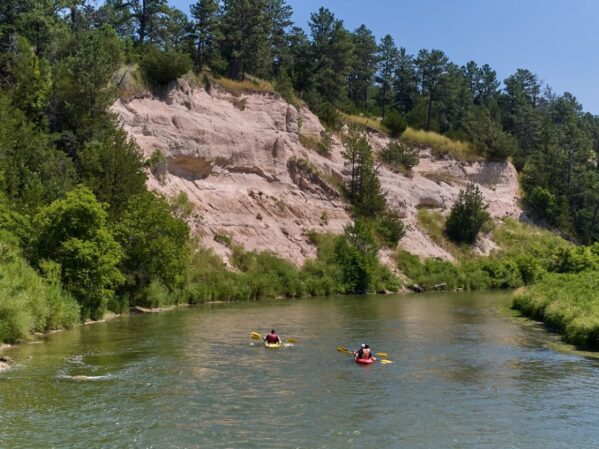
The Niobrara River begins in the high plains of eastern Wyoming and flows 535 miles to its confluence with the Missouri River in northeastern Nebraska. Hundreds of springs feed the Niobrara as it flows through the Sandhills region—one of the largest grass stabilized dune regions in the world. The Niobrara River drains 12,600 square miles in Nebraska and cuts through several rock formations including the Ash Hollow, Valentine, Rosebud, and Pierre. In north central Nebraska, the 100th Meridian splits the middle of the Niobrara River Valley. Here humid eastern and dry western air masses collide, creating a unique mixing zone for several species of plants and animals. Six major ecosystem types converge in the valley, including northern boreal forest, western coniferous forest, eastern deciduous forest, tallgrass prairie, mixed-grass prairie, and Sandhills prairie (a distinct type of mixed-grass prairie). In October of 2023, the Niobrara River was named the United States’ first “Quiet Trail” by nonprofit Quiet Parks International. The designation is awarded to destinations boasting the near total absence of manmade noise.
Looking for resources? Login to view more.
Send us feedback on this and other locations.
Coming up next:

Smith Falls State Park
Valentine, NE; Cherry County
Smith Fall State Park – located in north, central Nebraska – is home to Nebraska’s tallest waterfall. This park features several interesting specie including aspen and birch – two species rarely found in Nebraska. Learn about the geology, plants, animals and the fun you can have in this cool park.
Team Manager Login ![]()
These buttons follow the default direction of each route. You can use the previous button to move in the opposite direction, or edit your team’s settings in the manager dashboard.